Pipeline Simulation
Model flow, pressure, and demand across the network. Validate hydraulic behaviour before you dig, and stress-test what-if scenarios on real geometry.
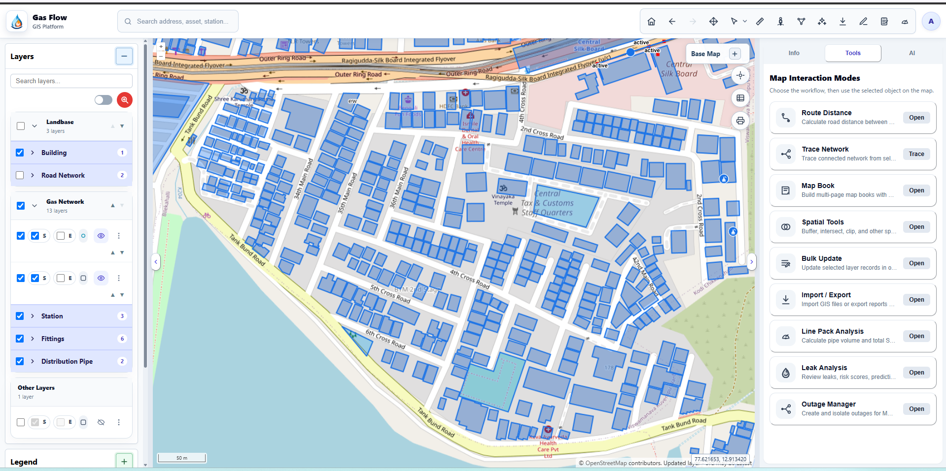
Gas Flow is a web GIS for gas utilities from GISMinds. Map every station, fitting, and pipe, inspect feature attributes, and run planning and operations tools — all in the browser, no desktop install needed.
Gas Flow
Gas Flow is the gas-distribution module built on GIS Core — purpose-built tools for planning, simulating, and operating MDPE and steel pipeline networks, from CGS to the last service connection.
Model flow, pressure, and demand across the network. Validate hydraulic behaviour before you dig, and stress-test what-if scenarios on real geometry.
Lay out stations, distribution mains, and service lines with snapping, route distance, and design rules — turning survey data into a build-ready plan.
Create and isolate outages for MDPE and steel pipes. Trace the network upstream to find valves to close and see exactly which customers are affected.
Review reported leaks, risk scores, and predictions in one place, then schedule inspection tasks and track them through to resolution.
Trace connected assets from any selected feature — follow gas flow through stations, fittings, and pipes to understand connectivity and dependencies.
Calculate pipe volume and total SCM line pack across a selection, so operators know how much gas the network holds at any moment.
Why Gas Flow
Not a generic mapping tool. Gas Flow understands stations, fittings, pipes, and their connectivity — so your map behaves like a real network, not just lines on a basemap.
Field crews and planners get a clear map view with search, filters, and one-click feature info — no need to learn query builders or spatial SQL.
WFS, WMS, GeoJSON, PostGIS under the hood. Your data stays portable. Connect existing GeoServer workspaces or bring your own layers.
Survey in the field, edit on mobile, and sync when you're back online. Multiple crews can work the same network concurrently without stepping on each other.
Browser-based, cloud-hosted. Onboard a new team member in under a minute. Scale from five users to five hundred without new infrastructure.
Run on AWS, on-prem, or a hybrid — GIS Core is self-contained and ships as Docker images. Your data never leaves your control.
Get in touch
Tell us about your team and the maps you work with. We'll set up a walkthrough with your own sample data — usually within a week.